Monday, 14 September 2020

A River Stour Scrapbook (part two)

We left it last time with boats scattered along the foreshore and the tide gradually making its way back in.

You may be wondering exactly how to pronounce the name of this river
and the truth seems to be that no one knows for sure.
Some people rhyme it with the word "tour",
others rhyme it with "tor" or perhaps "tower".
And there seem to be various opinions on what the word might mean too.


I was attracted to this little patch of seaweed,
its repeating shapes and unusual colours.


This boat, or half a boat, seems to have been abandoned long ago.
Growing beside it is a young oak, not the kind of tree 
you'd expect to see growing in such a place.


But there are oaks growing all along this side of the estuary.
I imagine they self-seed from acorns washed in on the tide
from the oak woods a little further downstream.


Both Stour Wood and Copperas Wood are managed as bird reserves,
with plenty of oaks and hornbeam trees.

And bracken.


A few birch trees for variety.
In springtime these woodlands are full of songbirds 
singing to defend their territories.


But there are other glories to be enjoyed as Autumn
takes its first tentative steps.
It was incredibly quiet in Copperas Wood in particular,
considering what lies a short distance away.


The ports of Felixstowe and Harwich lie on opposite sides of the river mouth
with their container depots, ferry terminals and refinery.
Those dark splodges on the shoreline are Curlews and
there's a Swan on the water too,
all apparently unconcerned about the industrial scenes
just over their shoulders.
That shot was taken with a long lens,
but even so lets retrace our steps back upstream.


I'm aware that my last post promised "even stranger things"
and to find that you have to take just a few steps inland...


This remarkable house was designed by the cross-dressing artist Grayson Perry
as a shrine to his fictitious "secular saint", Julie Cope, and a tribute
to the much underrated county of Essex.
People just call it "The Grayson Perry House"
and the artist is not at all averse to the self-promoting publicity.

And you can rent it for your holiday home
 should you have the inclination and financial resources.
Be warned though, some have described the experience as akin
to "living inside a migraine".
You can view the remarkable interior here:
We think we saw the person who is renting it at present:
he was sitting outside!


And just a short walk away you will find the perfect restful antidote
to the visual excesses of Mr Perry....


Take care


Saturday, 12 September 2020

A River Stour Scrapbook (part one)

The River Stour seeps up to the surface in a field in Cambridgeshire, flows on through picturesque villages and the town of Sudbury, birthplace of the artist Thomas Gainsborough, before continuing to Dedham Vale, made famous by the paintings of John Constable. So it's no surprise that, as it nears he end of its journey, its estuary is one of the more attractive ones along the North Sea coast of East Anglia. Here are a collection of views and curiosities to be found along the southern shore of the river mouth, interspersed with plenty of pictures of boats.


This stretch along the estuary side has several nature reserves,
none of which may be nationally known though all are well worth a visit.
Above is the scene from Wrabness Reserve which has a much
less peaceful past - it was once the site of a mine depot, from which the navy
planted wartime mines, and afterwards carried out the important business
of making them safe again.


It's not really the ideal time of year to see lots of birdlife;
many more waders and ducks will be present during the winter months.


Like many coastal locations in the UK there's a few rough shacks to be seen.
These were built before the days of planning regulations by 
those wanting to escape the cities at weekends and do a little boating.
Many of us would secretly like to own such a place.


I rather like the informality of it all.


It may look untidy, though I think most of what you see above 
are improvised moorings and anchors for small boats.


It all looks rather grander on the other side of the estuary.
Can you see the long, low building with the central tower?
Pass the binoculars, will you?


Certainly!
That's the Royal Hospital School which does not, as you might suppose,
educate sick children or even train people in the medical profession.
Historically it used to train boys to be sailors.
Nowadays it's co-educational and provides a much wider education,
though it still maintains strong links with the Navy.


As we were walking along we met a man walking his dog and asked
 him if we could walk along the beach where no path was marked.
He told us we could then added that we should look at the low cliffs as
you could see the volcanic layer "from right back when the world was made"!


It all sounded very unlikely and all we found were layers of sedimentary rocks.
But when I got home I checked out his story in my geology books.
He wasn't entirely wrong either. In among the layers of mud and sands, that
make up these rocks, there are thin layers of volcanic ash which are thought 
to have originated from eruptions as far away as Scotland.
Never ignore what you are told by men walking their dogs!


There are even stranger things to be found around here
but they'll have to wait for the next time.

I'll finish by showing you the extreme lengths that my brother Les
will go to to remain hidden from wildlife...

No, not really!
He'd just found a comfy place to sit and eat his sandwiches,
but he gradually slid down into a little hollow
 until all I could see from where I was sitting
was his head.


Take care.

Thursday, 10 September 2020

A Mosey From Kersey To Lindsey

 (Mosey [ˈməʊzi] - to walk or move in a leisurely manner).


Having walked through Kersey we continued north into the fields beyond. I'll spare you the first mile or so as most of it was across a recently ploughed field. There was no path of course and the going was hard, but we arrived at a small wood exactly where we were supposed to be. Soon we entered some rolling meadows.


We picked up a very minor single track road and followed it towards Lindsey.


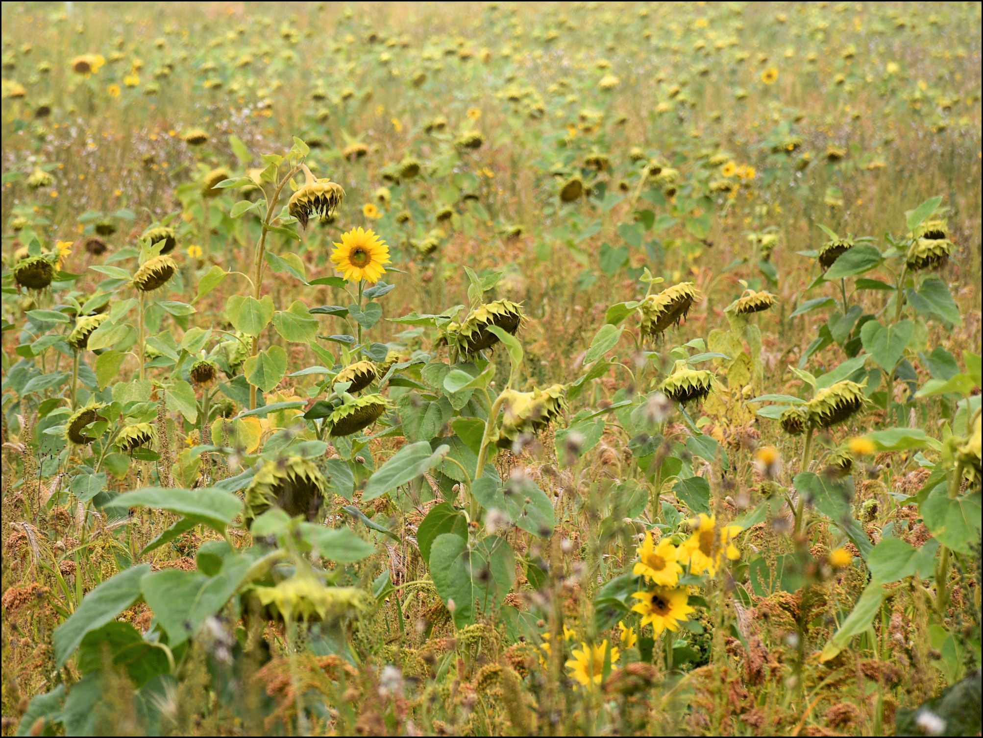
Sunflowers are an unusual crop to find in the English countryside, though in recent years farmers have been experimenting with all kinds of alternative crops, some of which you may have seen if you've been following this blog.


Lindsey Church appeared across the fields. After the grandeur of Kersey Church it appears to be a much more modest building. And Lindsey itself is a smaller village, not much more than a scattering of homes along a network of narrow roads.


It once used to have two pubs, one at either end of the village, known as the Red Rose and the White Rose. The flowers they were named after are represented on the village sign.


Ah, here's that church, standing in its little churchyard.


Every so often we spotted pretty little houses tucked in among the trees as dwellings seem to be scattered far and wide across the parish; not all English villages are neatly gathered together in a single group, "nucleated settlements" as geographers call them.


Shortly afterwards we found a path that wasn't there - that is to say that it started off promisingly but petered out in a thicket of thorny bushes, necessitating an about-turn and a hasty retreat. It meant a bit more road-walking but who's complaining when the roads are like this...


Not exactly a busy thoroughfare, is it? You might think that such a place had never been of any importance, but that's not the case and a small clue can be found tucked away at the side of the road.


Behind the parked cars stands a primitive stone building with a thatched roof. It could be a barn, though those windows look like they come from a medieval chapel. Luckily we can have a look inside.


This is St James' Chapel, dating from around the year 1250, and it was used as a farm building for many years. But in its heyday it belonged to Lindsey Castle, though the latter building has disappeared apart from a few earthworks which are hidden today beneath woodland. So this little village must once have been of strategic importance.


Now it was time to mosey from Lindsey back to Kersey. From here on the paths were clear to follow, not blocked by brambles or ploughed up, and led through very pleasant cattle pastures.


They led us down into a valley where there was a little stream, the infant River Brett on its way to Kersey where it will trickle across the village street as a picturesque ford. The path ran alongside the "river" and brought us out near allotment gardens in the village. All we had to do now was make our way back to the car, which we'd left near the church.


And, as you may recall, that church is up on top of the hill - at the top of these well-worn steps.


Take care.


Tuesday, 8 September 2020

In Kersey


The little village of Kersey lies tucked in a fold of the Suffolk countryside, hidden away from the bustling world of the twenty-first century. Or so you might think.....


....except that almost everyone knows it's there and people have been visiting this out-of-the-way place for many years...many, many years in fact.


It has the kind of ancient beauty that's hard to ignore. Although it's basically one narrow street that's less than half a mile (0.8 Km) in length, there are 40 listed buildings along its length (buildings that are protected as being of great historical or cultural interest).

In summer (at least in a normal summer) this place can be heaving with tourists and even if you never visit you'll probably encounter photographs of it on calendars or catch sight of it in an episode of "Lovejoy"!


Even in the early days of motoring it was a significant enough destination to persuade the AA to erect one of its signs to help its members on their way.


This little place had its own market as far back as the thirteenth century and, like many of the villages in this area, probably owes much of its historical importance to the manufacture and trade in wool and textiles. There was even a kind of coarse woollen cloth called "kersey". However the village's website says that historical evidence for all this is hard to find.


I also learned from various sources that there was also another matter putting Kersey on the map in Medieval times.


On the hill at the south end of The Street stands the village church which, through its tall tower and imposing location, gives the feeling of being larger than it actually is. Back in the fourteenth century this became a place of pilgrimage on account of "the many miracles" that occurred there.


The shrine in the church and the idea of pilgrimage did not survive the political and religious upheavals of the seventeenth century, but in 2020 the Shrine was "re-hallowed", though at present, like many other institutions, it's operating via the internet.


I didn't enter the church to see the Shrine so I'll have to rely on the power of the lucky black cat that crossed my path.


Just a few more pictures before we set out on a walk in the surrounding countryside....


The door of a fine old house, right next to the ford. I noticed that it was For Sale if anyone's interested.


That last shot was taken at the start of the walk, using a telephoto lens and looking back over the village through a hole in the hedge. The rest of the walk will have to wait for the next post.


Take care