Showing posts with label Buckinghamshire. Show all posts

Monday, 5 June 2023

Tales From The Towpath - Part Two

When you left us last time I had my map in one hand and was scratching my head with the other. My brother, Les, was meanwhile trying to get a signal on his phone so he could bring up a map on there. We came up with our answers at about the same time and for once technology and paper map were in perfect agreement - and on route!


If we just take a few steps in a northerly direction we should come upon a track leading us down to the bird hide on Wilstone Reservoir.


Abracadabra! Plenty of birds and a pretty view. A chilly wind blowing in our faces and not the Black Terns that we were hoping to see, but you can't have everything, even on such a varied walk as this. 


The path then led us along the raised bank of the reservoir. It's another of the four reservoirs built to keep the canals topped up with water, especially during the summer months. There's a car park near here so it's quite a popular walk. We took the flight of steps down to the road, then found a path over a grassy field towards the village of Wilstone.


Like almost every village in England there's a well-maintained war memorial.


There's a pub too, The Half Moon, which didn't tempt us inside as we still had a way to go (and our packed lunches were in a cool box in the car). There were once four pubs here, as well as a few shops. Most of these owed their existence to the relative prosperity brought to the area by the canals. But the coming of the car meant that more folk went to the nearest town for their shopping and entertainment.


We followed a track to the Aylesbury Arm of the Grand Union which was opened 1814. We could then enjoy a trouble-free and pleasant stroll on the towpath all the way back to our starting point.


A comment on the previous post said how magnificent the hawthorn blossom was this year, and nowhere more so than along this section, where many of the bushes had turned pink.


This section of the canal network almost closed in the 1960s, but the Aylesbury Canal Society was formed to care for, promote and protect it for the future. I remember some of my school friends volunteering and spending their summer holidays involved in restoration work on the canals. One met his future wife while they were digging out black sludge from the locks.


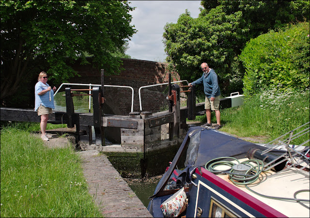
And all so that people could cruise on England's waterways today. You'll notice that the locks here are only just wide enough to accommodate the boat. They were constructed this way, just 7ft (just over 2m) wide in an attempt to save as much water as possible, though it does restrict the size of vessel which can use this branch of the canal.


But soon we reach the junction with the much wider Grand Union Canal itself, which will lead us back to Startop's End (pronounced Starrups, by the way).


Even though the canal is wider the bridges were kept fairly small as the engineers always sought to make savings. And well they might: according to the Canals and Rivers Trust there are some 2,949 bridges on Britain's canals, as well as 1,582 locks, 55 tunnels, 280 aqueducts and 71 reservoirs. Quite an undertaking then.


Most of the boats you see today are pleasure craft which people hire for a week or two's cruising during the summer. Some are privately owned and in use for part of the year. And it's reckoned that around 15.000 people live on boats in the UK, though this includes canals, rivers and coasts. Among that number must be my friend and former work colleague who invested in an old boat as a cheap form of housing and over the years has converted it into a bottomless pit into which he pours his hard-earned cash. Mostly though he just watches the river flow by his window and doesn't seem to worry too much about it.


This unusual bridge was encountered right at the end of our walk. You'll notice it has a double arch, one over the canal and the other over....nothing! The explanation is that there was once a plan to build a narrow lock, next to the wider one, so that if a single narrowboat wanted to pass it would waste less water. For some reason the "cunning plan" never came to fruition.


I went up on the bridge to take a shot down on to the canal and then we walked back towards the car, but.......


On the way we came across the Paul Mark that we'd seen earlier in the day chugging along the Wendover Arm. Since then it had negotiated half a dozen locks and the owners were now moored up for a well-earned cup of tea. Les and I had been discussing how there seemed less traditionally-painted craft afloat these days and were pleased to see at least one boat with the once-popular "castle" design.


We began chatting to the owners. They'd had their boat 47 years, but now only ventured on short trips in her. The water-can, painted with the roses which you used to see on so many narrowboats, was a wedding anniversary present and had to be commissioned from one of the few artists still working in the field. If you look closely you'll see that those seemingly intricate flowers are rendered with just a few highly skillful strokes of the brush.


They also had an extensive collection of the metal badges which proclaim each of the canals they've travelled on. Again you used to see a lot more of these on boats a few years back. We said our goodbyes and then took one last look at the reservoirs and part of the sluice system which allowed water to be let into the canal.


Take care.


Saturday, 3 June 2023

Tales From The Towpath - Part One

The title of the post and the first photo should tell you that we're off on a different kind of walk today, along a small fragment of Britain's canal system. We're near the little Hertfordshire town of Tring, on part of the Grand Union Canal. The "towpaths" were originally for the horses that towed the barges before the days of steam. Most of them now form a useful supplement to the footpath network.


The great "canal age" in Britain began in the 1760s when the Duke of Bridgewater built a canal from his coalfields to the town of Manchester. The Grand Junction Canal, which later became the Grand Union, was built later that century to give a better connection between London and Birmingham. Before it was built, boats had to go up the River Thames to Oxford and then transfer to the narrow and winding Oxford Canal. The new canal followed a much more direct route.


A couple of ducklings were having great fun ploughing through the fallen petals of May blossom.


The section we're walking is where the Grand Union Canal crosses the Chiltern Hills at their lowest point, which is known as Tring Gap. The Chilterns, even by southern English standards, are fairly insignificant hills, but they set the engineers plenty of problems, as we shall see.


At its highest point the canal is only 120 feet (37m) above sea level, a height which is easily achieved by a series of lock gates. However this is a busy canal and every time a boat passes water is lost. The solution was to build reservoirs near the highest point so that the water-level can be topped up.


They still serve this purpose today, though they also attract many birds (and birdwatchers).


A family of swans pose for a photo, though the cob (the male bird) insisted on lifting his foot in that strange way that they often do.


Most of the locks still retain the old lock-keepers' houses, which are today much sought-after properties, though the prospect of having every summer day filled with the noise of boating folks winding open the lock gates wouldn't fill me with glee.


Because this was formerly such a major thoroughfare, essential to the national economy, the Grand Union has a broad channel, wide enough to allow boats to moor or pass easily. Nowadays of course the canal is mainly used by leisure craft. Not every canal in the land is so well appointed or maintained as the Grand Union.


We're about to turn off the main canal and follow part of the Wendover Arm.


Above is the junction where we say farewell to the Grand Union's main artery, for a while at least.


Here, along the Wendover Arm, the atmosphere is totally different. Birds chirrup in the hawthorn bushes and we wondered if we'd see any traffic at all on this dead-end spur of the network.


Just then the "Paul Mark" came puttering along through the tranquil scene. Remember the name and the boat, we'll meet up again towards the end of the second episode of this placid adventure.


An occasional glimpse through the hedges confirmed that we were travelling through farming country. Much of the original traffic on this canal would have consisted of agricultural produce on its way down to London - and horse manure being transported back to enrich the fields.


Then suddenly the canal-side scenery seemed briefly urban. This is Heygates Flour Mill, which is still operating today and, though everything now moves in and out by road, it serves as a reminder of the canal's original purpose. Though the Wendover Arm did have another, less obvious, function. The Chilterns are formed of porous chalk, so there are very few natural watercourses that could be diverted to top up the canal's reservoirs. But it just so happens that there is a natural spring at Wendover, at about the right elevation, so the canal therefore could also serve to bring water to where it was needed.


We passed under a traditional-looking bridge which is actually quite recent, having been rebuilt as part of the restoration scheme for the Wendover Arm of the canal. You remember I said the chalk was porous? Well, this unfortunate canal sprang a leak, several leaks in fact. After many attempts at patching things up it was eventually given up as a bad job, blocked off and allowed to silt up. It's only in recent decades that parts of it have been opened up once more.


And soon we reached a place where the canal came to an end and our path seemed blocked. Luckily there were a couple of boats moored in this out-of-the-way place. Les got talking to a woman on one boat. She wasn't sure where the path went, but she directed us to the man in the other boat, he'd be bound to know. He cut a piratical figure with his gold earring and bandana, but gave us a full and detailed description of the route ahead.


After an excursion through sheep meadows and cattle pastures we came upon a section of restored canal. Then we had to cut away again along an uncertain path across the fields, hoping that it would lead us towards the bird-hide at Winstone Reservoir and the second half of our journey.


Take care.


Thursday, 10 June 2021

In A High Place


"High" is of course a relative term. And in the context of the low, green countryside of south-east England, Ivinghoe Beacon (at the dizzying altitude of 757 feet, or 233 metres) above sea level is considered a high place indeed! It can be seen from afar and has held different attractions for people over the ages.


Nowadays it's much more popular than it's ever been, as people with time and energy to spare, from the youngest to the oldest, come to toddle or totter to the topmost point to wonder at the beauty of it all.


And this week it was the destination of choice for my brother and myself. Being a couple of perverse old codgers, we set off towards the summit in a downhill direction! The thin soils here overlie the chalk that forms a large swathe of southern England. Where many feet tread the soil soon wears thin and the paths show up as thin white lines through the green. And in places where people veer about to avoid wet patches it can soon form a wide thoroughfare that takes many years to heal again.


After a while we found ourselves walking beside a low, raised mound. It might not look like much but it was raised over the bodies of people who died around 3,500 years ago. It's a burial mound from the Bronze Age. It's thought that they chose high places like this so that their ancestors might look down over their lands, making it clear any incomers that this land was taken.


The land would have been more wooded in those times, even though it was already being cleared by these early farming folk. Just how much was cleared at various times in ancient history is a matter of much debate.


The first top we reached was Gallows Hill and I'm sure you can work out how it got that name. It was quite normal to hang offenders in places where they could be seen all around, presumably as a warning to everyone to keep within the law. Nowadays sheep arrange themselves randomly but pleasantly on that same hillside.


Hawthorn bushes are also dotted artistically across the land.


That's Ivinghoe Beacon off in the distance on the left of the above picture. The Ordnance Survey's maps would have you know that it's officially called Beacon Hill and Ivinghoe is just the nearest village down in the valley. But there are many "Beacon Hills" throughout England. They all formed an essential part of national security at one time; if there was an invasion then the beacons would be lit across the land.


And here's the view from very near the top of Ivinghoe Beacon, a grand place to sit on the grass and absorb the scene. And what always strikes me from such high places is how little of our modern world of motorways, factories and shopping centres is visible. It's quite a different perspective of the country from that gained from inside a car.


During the Iron Age this hilltop was one of many used as a hill fort. The old idea was that these were defensive sites used by warring tribes, but more recent archaeological evidence points to a more ceremonial site built for reasons of prestige. My own idea, for what it's worth, is that they would have been built as places where food stores and animals might be defended in times of famine. I base this idea on the fact that tribes in Africa only usually came into conflict when food was scarce. Farmers are far too busy to fight in normal times. 


Most of the defensive ditches around the hill fort are difficult to make out today, but to the south-west of the fort, which would otherwise be the easiest approach, quite obvious banks and ditches can still be made out.


Our route was suddenly running through a woodland that was busy with birdsong.


We didn't need to go through this little gate at all, but we had time to spare so we thought we'd take a quick look.


And we soon found ourselves overlooking a deep hollow called Incombe Hole, set back into the hillside. 


Pitstone Windmill showed up clearly against the green fields, looking rather like a child's toy placed haphazardly on the landscape. As anyone who has been following this blog for a while will guess, it's almost certainly built at a very precise location where the wind is usually at its strongest; people of the past were extremely knowledgeable about the subtleties of the natural world around them. The mill, like much of the land around here, is in the care of the National Trust.


This charming nook of land, just through the gate we saw earlier, seemed so little-visited compared to the well-worn path to Ivinghoe Beacon. Surprising really, as it's only a few hundred yards from the car park.


Take care.