Monday 30 November 2015

Cottenham Point-To-Point


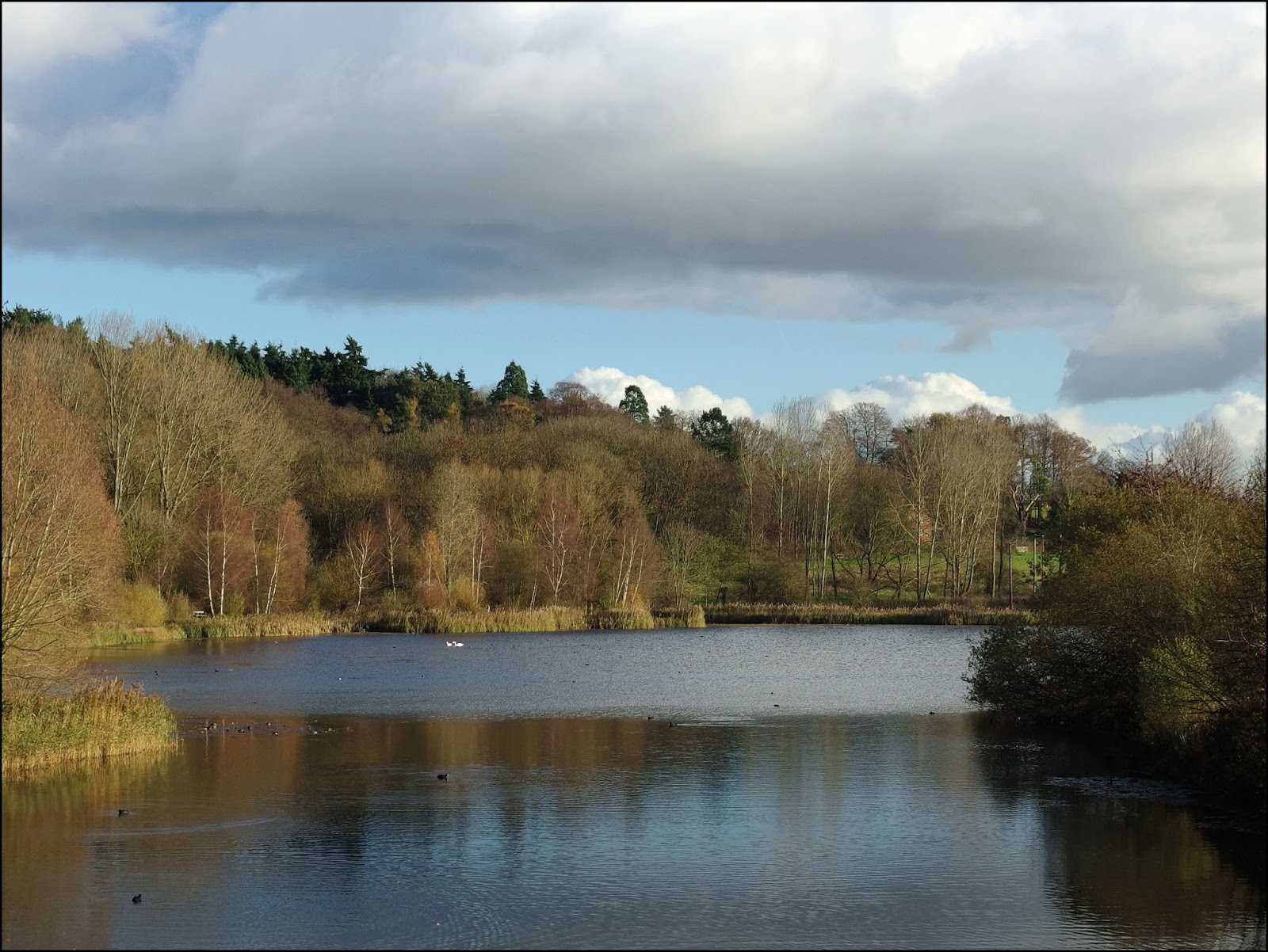
A Day At The Races:  The weather forecast was for rain, wind and overcast skies; nor really a day for a walk. But there was a point-to point meeting though at Cottenham, just north of Cambridge, so I decided to re-visit an event I hadn't been to for years.


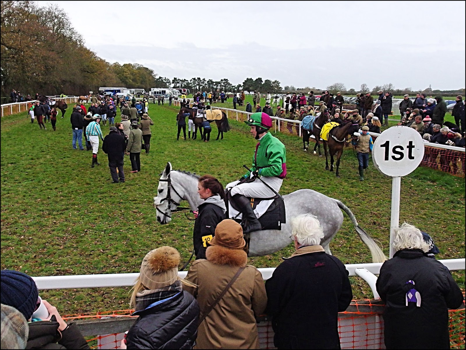
Point-To-Point:  For those who haven't worked it out from the pictures it's a type of horse racing over fences. The oldest record we have for anything like it is from Ireland in 1752 when two neighbours raced each other across country from one church to another. Riders could take any route they wanted to, using the church steeple as a marker. Consequently such races became known as "steeplechases".


The phrase "point-to-point" was not used till 1875, though the rules seem to have been much the same. All this is rather academic anyway since people have surely raced on horses for as long as they've been riding them and if things got in the way they must have jumped over them.


The Way It Is Now:  Over the years things have become more organised. Nowadays there is a roughly oval racecourse, specially built fences, rails where they are needed to guide the horses on the correct course. There are facilities for spectators and jockeys though often they're quite basic. But the days of farmers racing against one another on their hunting horses are largely a thing of the past


Point-to-point still maintains close connections with the world of fox-hunting and is an amateur sport. It's a lot more low-key than the professional circuit, which is known, a little confusingly, as National Hunt racing. In National Hunt racing the races can be over various distances and can be over fences or hurdles, point-to-point races are over fences and usually over a three-mile course.


In The News:  Point-to-point meetings don't usually get much coverage in the papers, but this year there have been stories that Olympic cycling medallist, Victoria Pendleton, in a bold attempt to switch sports, was going to make her debut over jumps at Cottenham, but in the end she decided to race elsewhere. It didn't seem to detract from the days entertainment and several leading jockeys, like Gina Andrews (above), served up some great racing.


The Bookie:  Many people attending the meeting examined their racecards in great detail in an attempt to find the winners and defeat the on-course bookmakers. It adds a little spice to the day, but if you understand the mathematics then you'll know that it's the bookie whose bound to win out in the end. There was a whole row of them for you to give your money to. None of them ran out of money and went home during the afternoon!


The Winner:  Although the sport is amateur there are small prizes for the winners, though I doubt they would even pay for the feed for very long. However the joy for the jockeys, owners, trainers and all those connected with stable is still clear to see.


The Weather:  In the end the pessimism of the Meteorological Office was ill-founded. Although it was cloudy and windy it stayed dry - so many more days out are ruined by bad weather forecasts than are ever spoiled by bad weather! 


I did have doubts when I saw the runners in the first race however; they included horses called Storm Lantern and Weather Warning!


Goodbye:  Racing was all finished by three o'clock, though leaving was delayed for a few minutes while they rounded up horses that had fallen and lost their riders during the last race. If you want to find out about point-to-point meetings this winter then you can find them here: https://www.pointtopoint.co.uk/fixtures


Take care.


Saturday 28 November 2015

The Valley Of The River Ash


The River Ash is a little darling of a stream. Some years ago I started going to Amwell Nature Reserve near Ware. In those days there was only one tiny hide and a raised area known as The Viewpoint where all the birdwatchers gathered and set up their telescopes. Around lunchtime I'd drift away and stroll a little way along the Ash to enjoy my sandwiches and flask in a sheltered hollow near the river.


I'd long had a wish to explore other parts of the river but until the other day I'd done nothing about it. But first I had to get there. So I hopped off the bus at Puckeridge, then headed across the fields towards Much Hadham.


I approached the village along a wooded, sunken lane thick with autumn leaves. 


Into Much Hadham to take some pictures that you may have seen in the previous post. But all the time I was aware that the river was running just behind the houses, so about half way along the long, long village street I ducked down a footpath to cross the river by the footbridge beside a rather deep ford. Unlike some other places there's some justification in owning a big, four-wheel drive vehicle in Much Hadham!


The overcast skies were starting to clear giving rise to ripple-effect clouds, altocumulus undulatus to give them their Sunday name. 


But soon I was walking through woodland with just occasional glimpses of the valley down to my right.


As I slowly descended back towards the river I noticed several odd remnants from some former use of the land - an odd earth-bank here, a lump of concrete there - but couldn't figure out what it all meant. Then I found a small area of rather ramshackle land; I don't think anyone is still living in the caravan, though they may just be. It's all very different from Much Hadham, just up the valley.


The river often floods and the village of Widford keeps its feet dry by standing up on a low ridge. Meanwhile the flood plain is mostly given over to grazing land.


The sun was playing an infuriating game of hide-and-seek, lighting the scene beautifully one moment then, in an instant, clouding over again. I missed a lot more shots than I got!


The stream winds around in a series of loops and meanders while the footpath sticks for a while to an old railway trackbed, though it's been abandoned for so long that everything now looks very natural.


The land around Watersplace Farm is so beautiful and well-managed that it makes me proud to live in England! 


The path crosses parkland heading towards the Amwell Walkway, another stretch of railway line converted to a footpath.


Crossing the River Ash for the last time today and heading into the Amwell Nature Reserve, an area of old flooded gravel pits which attracts a wide variety of waterfowl and waders.


I went to have a look but, not having my binoculars with me, didn't see a great deal. All that then remained was to walk the towpath of the River Lea Navigation towards Ware.


I hope you've enjoyed our little excursion along the Ash as I've a feeling I'll be doing the walk again before too long. 

Walker's Log:

    Start: Puckeridge, Hertfordshire 08.15

    End: Ware, Hertfordshire 15.00
    Distance walked: 11.5 miles (18.5 Km)
    Notable birds: Buzzard, Skylark, Kestrel, Grey Heron, Little Egret, Lapwing.
    Mammals: nothing except a few rabbits. 
    Churches: Much Hadham, Ware.

    People with dogs: 5
    Dogs with people: 8
    People just enjoying a walk: 1
    Cyclists: 0
    Horse riders: 0

Take care.


Thursday 26 November 2015

Much Hadham


Much Hadham in Hertfordshire is one of those picture-perfect English villages with ancient half-timbered houses lining its main street. And such perfection comes at a price; the cost of housing here is the highest in the area, though a number of grand mansions like the one below certainly boost the average....

The Hall - recently available to rent at just £6,500 per month!

The village has always been a sought-after location, even back in the tenth-century when the Bishops of London were bequeathed lands in the village. They built their palace next to the church and it was there that Edmund Tudor, father of Henry VII, was born in 1431. Or it could have been at Hadham in Bedfordshire, but don't breathe a word of it in Much Hadham.


The village used to be known as Great Hadham but no one seems to be sure why it changed to the peculiar, but much more memorable, Much Hadham.


No alcohol was consumed during the creation of the above photograph. Honest!


Most people would say that the village is strung out along the road, however a landscape historian might point out that the road itself also runs parallel to the little River Ash, which would have served as a water supply to the houses in times gone by. This historian might add that the Bishops of London had the good sense (and the power and influence) to live upsteam from the bulk of the population and so monopolised the cleanest water.


And who might this landscape historian be? Well, yours truly, though I'm certain that others will have reached the same conclusions. How I came to be interested in this at all is an interesting study in chance and decision-making. 


You see, I'd always preferred Geography to History, "maps" rather than "chaps". But in my second year studying the subject at university I was faced with the fact that if I wanted to attend lectures on Political Geography, which at the time I thought I did, I'd have to hang around all day on Friday for a lecture late in the afternoon. Very inconvenient. If, on the other hand, I chose to do Historical Geography I could have a three-day weekend. The rest, as they say, is History.


So I continued on my way down the street, snapping away at gardens, houses and details, crossing and re-crossing the road at great risk to life and limb.


Thinking about the River Ash and its influence on the layout of the village reminded me that I was actually on a walk, part of whose purpose was to follow the Ash valley. I soon slipped down a back alley towards the river, but not before I'd had a look around the church of course.


Take care.


Sunday 22 November 2015

Minor Details

A little colour collected this summer.
A little colour saved for a dull time of year.


Fairground Steps


Old Threshing Machine


Didgeridoos


Farmyard Door


Fungi Up Close


Ethnic Skirts


Rusty Wheel


Patched Up Diesel Tank


Take care.


Friday 20 November 2015

The Writing On The Wall


Someone had the bright idea of pinning up some sheets of paper and supplying marker pens for passers-by to record their thoughts and questions. As this is in the midst of the university area of Cambridge you might expect more profound questions than "Where's the nearest pub?" though I'm afraid you'd be wrong. In fairness I got fed up of waiting for the young man in the picture to finish his lengthy discourse and wandered off to find more permanent words on walls.


A little way along the street from the first picture stands St Botolph's Church. It's an interesting building and someday I'll invest some time to photographing it properly, but for now I'll just show you the little plaque above. This is one of the ways that social care was funded in days gone by. I'm surprised to see such a large sum being bequeathed by a bricklayer as it would be like saving £97,000 today (though such calculations are fraught with difficulty). It's also unusual to see such a donation commemorated in this way. 


"Near this place lies the body of Francis Squire who departed this life ye 29th of december 1732 in ye 65 year of his age"  What caught my attention here was the rather gruesome skull which, although not to modern taste, was quite a common symbol on old gravestones.

I often find myself reading the names on war memorials and wondering at the senseless loss of life recorded on them, but this is the first one that's ever made me smile - whatever possessed anyone to name their son W.O.R.KING ?????


Graffiti in churches is a lot more abundant than you might think; sometimes the builders left their mark but mostly it was just local people making a bid to be remembered for eternity. Or at least for 216 years and counting.


Another odd scratching inside a church. It seems to be a representation of a warrior or knight of some kind, possibly St George. Nobody seems to know much about this one except that it's very old.


And finally I can never resist a bit of grandiloquent Victorian prose:


COUNTY OF HERTFORD
TAKE NOTICE         THAT  THIS  BRIDGE  IS
INSUFFICIENT  TO  CARRY  WEIGHTS  BEYOND  THE
ORDINARY TRAFFIC OF THE DISTRICT,AND THAT OWNERS
AND ALL OTHER PERSONS IN CHARGE OF LOCOMOTIVES,AND 
ALL  OTHER  PONDEROUS  CARRIAGES, ARE  WARNED
AGAINST  ATTEMPTING  THE  PASSAGE  OF  THE  BRIDGE.
___________________

BY ORDER OF THE COUNTY COUNCIL
            C.E.LONGMORE,
                                               CLERK OF THE COUNTY COUNCIL.
HERTFORD.                            
23RD OCTOBER, 1899.

Regular readers might remember from the post about steam traction engines that the largest examples of such vehicles were known as "road locomotives" and these huge machines (along with other ponderous carriages) were what posed a danger to the structure of the bridge. It must have been a real problem at the time as roads were simply not designed for such large weights. Whatever one thinks of the ponderous prose it seems to have done the trick - the bridge is still standing.


Take care.